Schlacht bei Wavre
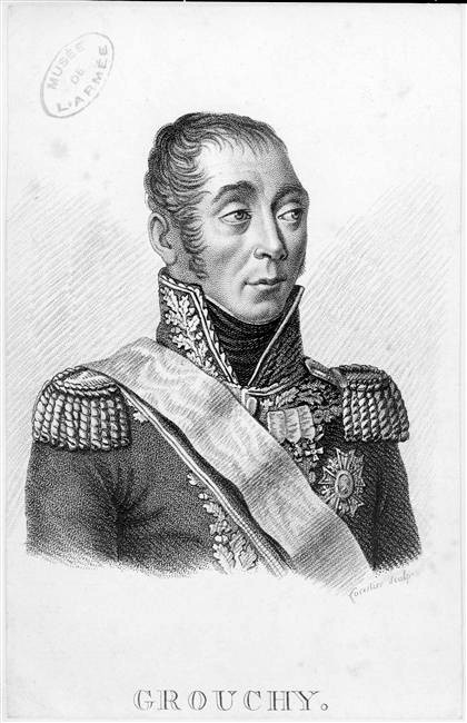
Emmanuel de Grouchy (1766-1847), Marschall von Frankreich

Mapa tažení vojenských sil před a během bitvy u Waterloo, 15.–18. června 1815.

Map of force movements and major engagements during the Waterloo Campaign, June 15-18, 1815.

Waterloo campaign map

Battle of Wavre, 18 & 19 June 1815. A.K. Johnston F.R.G.S. William Blackwood and Sons, Edinburgh and London. (to accompany) Atlas to Alison's history of Europe ... MDCCCLII (1852). Engraved hand colored battle plan. Shows the position of the Prussians and French cavalry, infantry and artillery. In lower right margin: W. & A.K. Johnston, Edinr. Relief shown by hachures. Atlas to Alison's history of Europe : constructed and arranged under the direction of Sir Archibald Alison, by Alex Keith Johnston, with a concise vocabulary of military and marine terms. Library edition. William Blackwood and Sons, Edinburgh and London. MDCCCLII (1852). Atlas to accompany Alison's History of Europe: from the commencement of the French Revolution in 1789 to the restoration of the Bourbons in 1815. Atlas consists of a series of maps and plans that cover major military engagements during the French Revolution. Complete with 108 maps and plans, a frontispiece on military symbols and fortifications, and a glossary of military and marine terms. Maps engraved by W. & A.K. Johnston under the direction of Sir Archibald Alison. The maps cover Europe and her colonies in America, Africa and India. Bound in half calf over marbled-paper boards, with gilt-blocked label "Alison's history of Europe, Atlas" on spine.

Plaque to commemorate the fighting of the Stoffel batallion (June 16th and 18th 1815) to defend a bridge in the town of Wavre (Brabant) Belgium.

Les couleurs des drapeaux du royaume des Pays-bas et de l'empire Français n'étaient pas bonnes. J'ai mis à jour la carte.

Eglise Saint Jean Baptiste de Wavre. Plaque commémorative des combats de 1815. Boulet dans un des piliers.

French cannonball from the battle of Wavre in 1815, in one pillar of the church of Saint John in Wavre, Belgium.
Historische Übersicht
Marschall Grouchy band preußische Truppen, verpasste aber die Hauptschlacht bei Waterloo.
Fakten auf einen Blick
Grande Armée (FRA)
- Befehlshaber: Emmanuel de Grouchy
- Truppenstärke: ca. 33.000
- Verluste: ca. 2.500
Königreich Preußen
- Befehlshaber: Johann v. Thielmann
- Truppenstärke: ca. 17.000
- Verluste: ca. 2.500
Strategischer Kontext
Versuch, den preußischen Zuzug nach Waterloo zu verhindern.
Weiterführende Literatur


Historische Orte
Die interaktive Karte erfordert die Zustimmung zu Drittanbieter-Cookies.