Kessel von Falaise
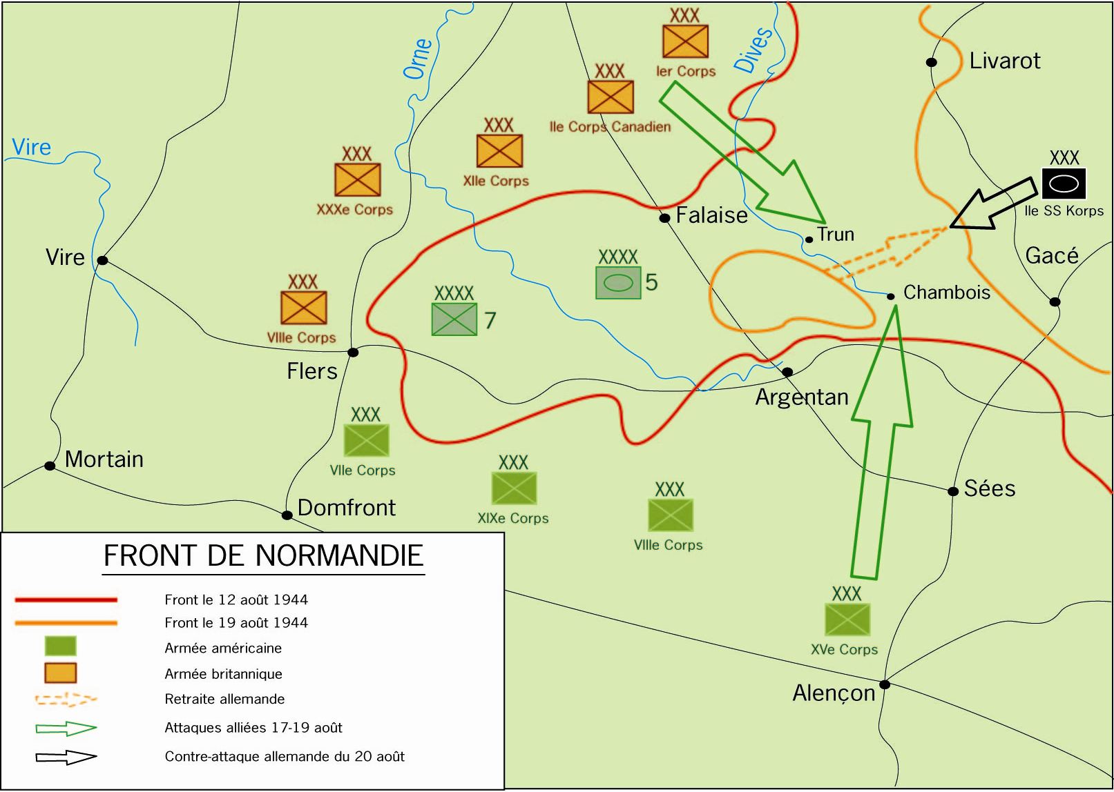
Carte de la bataille de la poche de Falaise

Leaving a cloud of dust behind them, American armoured forces race through Ballon in pursuit of the retreating Germans as the Falaise Gap narrows with American and British forces closing on both sides. Approximately 60,000 German prisoners besides thousands of German dead were trapped in the Falaise pocket
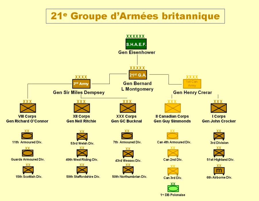
Organisation et composition de l'armée britannique. Organisation et composition de l'armée britannique.

Carro M4 Sherman della 2e division blindée francese in avanzata verso Argentan durante la battaglia di Normandia
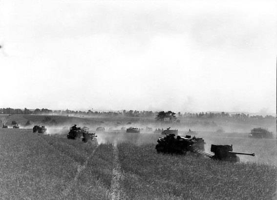
Vehicles of the 3rd Canadian Division advancing on Bretteville-le Rabet, France, towards Falaise as part of Operation Tractable

Japanese-American infantrymen of the 442nd Regimental Combat Team hike up a muddy French road in the Chambois Sector, France, in late 1944. (Army Center for Military History file photo)

Soldats américains dans Alençon en août 1944

Soldats américains dans Argentan libérée

Frankreich, bei Falaise, zerstörte Gebäude in Ortschaft

Frankreich, bei Falaise, Zerstörungen in Ortschaft
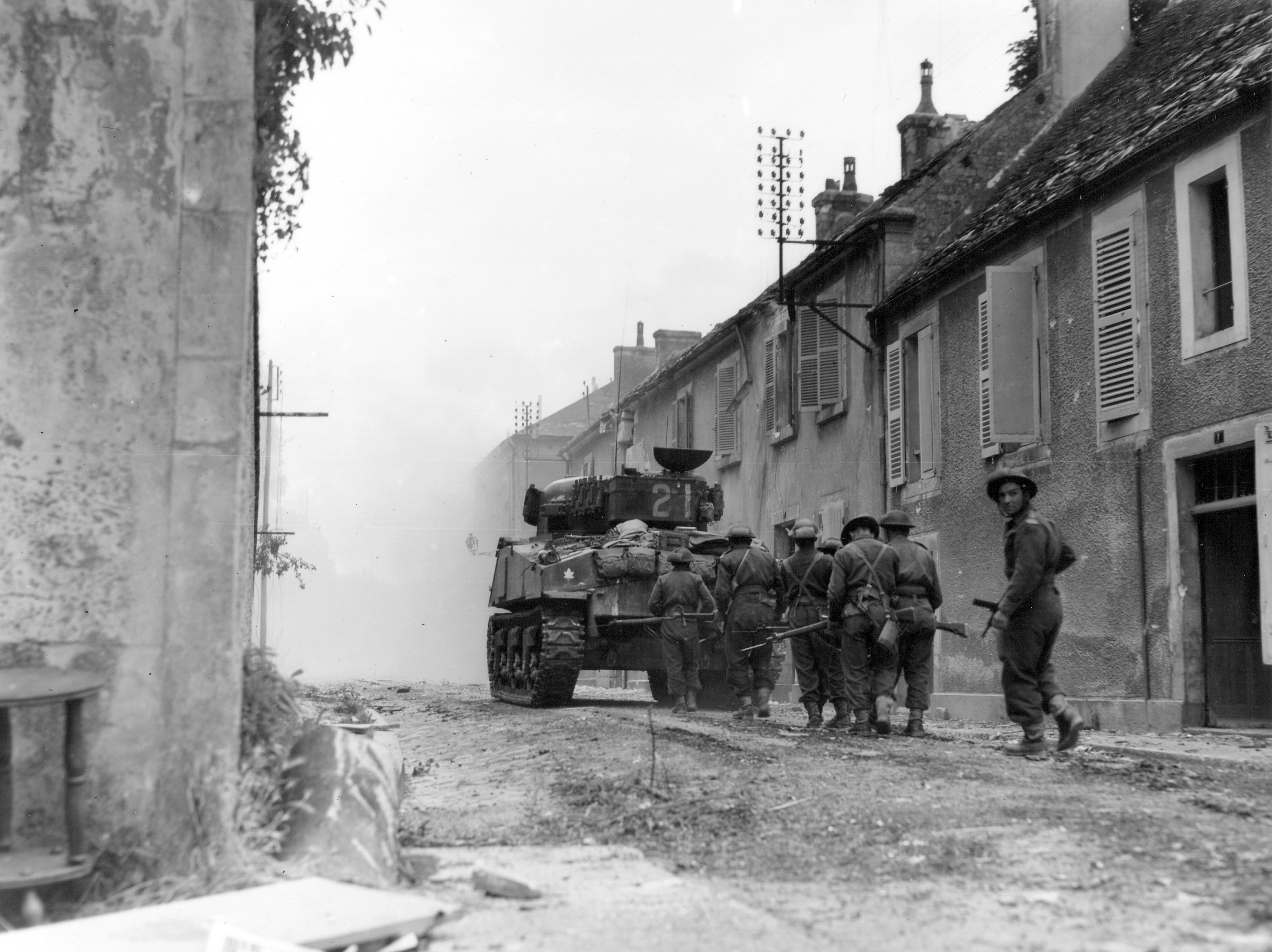
The Sherman tank "Bomb" of the Sherbrooke Fusiliers hunts snipers with troops of the Mont Royal Regiment in Falaise, August 17, 1944.

Soldier of Argyll & Sutherland Highlanders (4th Canadian Armoured Division) passing a destroyed Canadian tank in St. Lambert sur Dive

Canadian soldiers at Falaise town entrance
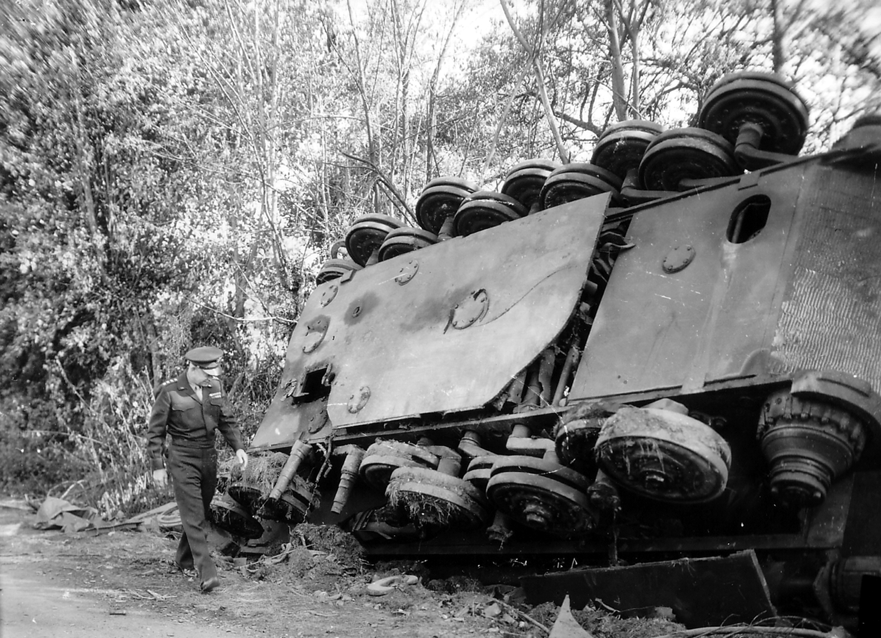
“IKE” INSPECTS THE WORK OF HIS MEN FRANCE – Gen. Dwight D. Eisenhower, supreme commander of the Allied expeditionary forces, inspects an overturned German tank left by a roadside in France by the retreating enemy.
General Elfeld of the German 84th Korps, having surrendered to Canadian & Polish forces on August 20, 1944.

encirclement

Map of the Normandy Battle August 1-13 1944

The bodies of dead German soldiers near a destroyed AFV in the Falaise Pocket, 12 August 1944. The vehicle appears to be a Sonderkraftfahrzeug 165 "Hummel" 150 mm self-propelled artillery.

Map of the en:Falaise_pocketadapted into Falaise_Pocket_map (rus).svg form (with a coupl of minor presentation changes).

La bolsa de Falaise

Map of the en:Falaise_pocket adapted into .svg form (with a coupl of minor presentation changes).

Schematic map of the Battle of Falaise, August 1944, in Polish

Falaise-katlan
![Map of the en:Falaise PocketDownloaded from [1]
en:Category:Maps of the history of Europe
en:Category:Maps of World War II in Europe](https://upload.wikimedia.org/wikipedia/commons/4/4b/Falaise_Pocket_map.jpg)
Map of the en:Falaise PocketDownloaded from [1] en:Category:Maps of the history of Europe en:Category:Maps of World War II in Europe

Map of the en:Falaise_pocket adapted into .svg form (with a coupl of minor presentation changes).
Historische Übersicht
Als Kessel von Falaise wird eine Schlacht im Zweiten Weltkrieg zwischen den westalliierten Streitkräften und der deutschen Wehrmacht bezeichnet. Nach dem erfolgreichen Verlauf des D-Day und dem Durchbrechen der deutschen Linien im Zuge der Operation Cobra kam es Anfang August 1944 südlich von Caen zur Kesselschlacht bei Falaise.
Fakten auf einen Blick
Allierte (Multinat.)
- Befehlshaber: B. Montgomery
- Truppenstärke: 350000
- Verluste: 10000
Wehrmacht
- Befehlshaber: Paul Hausser
- Truppenstärke: 150000
- Verluste: 60000
Strategischer Kontext
Einkesselung der deutschen Heeresgruppe B.
Weiterführende Literatur


Red Famine: Stalin's War on Ukraine


Die Schlacht um Berlin und das Ende des Dritten Reichs 1945

Hunde, wollt ihr ewig leben: ein Stalingrad-Roman

Roter Hunger: Stalins Krieg gegen die Ukraine


Söldner ohne Sold: Die deutschen Freikorps 1918–1923

Vom Massensturm zur Stoßtrupptaktik: Die deutsche Landkriegtaktik im Spiegel von Dienstvorschriften und Publizistik 1906 bis 1918

Wir Wehr-Wölfe: Erinnerungen eines Freikorps-Führers

Zweiter Weltkrieg Erlebnisbericht Apokalypse Stalingrad: Untergang der 6. Armee 1942-1943
Walter Mönch
Rise And Fall Of The Third Reich
William Shirer
Historische Orte
Die interaktive Karte erfordert die Zustimmung zu Drittanbieter-Cookies.